DSpace CRIS
DSpace-CRIS consists of a data model describing objects of interest to Research and Development and a set of tools to manage the data. Standard DSpace is used to deal with publications and data sets, whereas DSpace-CRIS involves other CRIS entities: Researcher Pages, Projects, Organization Units and Second Level Dynamic Objects (single entities specialized by a profile, such as Journal, Prize, Event etc; because any profile can define its own set of properties and nested objects)
Learn MorePlease use this identifier to cite or link to this item:
https://hdl.handle.net/10316.2/46127| Title: | High resolution fire hazard index based on satellite images | Other Titles: | Índice de riscos de incêndio de alta resolução com base em imagens satélites | Authors: | Laneve, Giovanni Fusilli, Lorenzo |
Keywords: | Satellite;hazard;fire;optical imagery;Satélite;perigo;incêndio;imagens ópticas | Issue Date: | 2019 | Publisher: | Imprensa da Universidade de Coimbra | Abstract: | Em dezembro de 2015, após 3 anos de atividade, o projeto FP7 PREFER (acrónimo de Space-based Information
Support for Prevention and REcovery of Forest Fires Emergency in the MediteRranean Area) foi concluído. O projeto
propunha-se a dar resposta à necessidade de melhorar a utilização de imagens de satélite em aplicações relacionadas
com serviços de emergência e, em particular, com os incêndios florestais. O projeto teve como principal objetivo o
desenvolvimento, validação e demonstração de produtos baseados em imagens ópticas e de radar (SAR - Synthetic
Aperture Radar) para apoio à prevenção de incêndios florestais, à avaliação de danos e recuperação de áreas ardidas.
Este artigo apresenta um dos produtos desenvolvidos no âmbito do projeto PREFER, numa versão aperfeiçoada,
designadamente o Índice Diário de Perigo de Incêndio (DFHI - Daily Fire Hazard Index). In December 2015, after 3 year of activity, the FP7 project PREFER (Space-based Information Support for Prevention and REcovery of Forest Fires Emergency in the MediteRranean Area) came to an end. The project was designed to respond to the need to improve the use of satellite images in applications related to the emergency services, in particular, to forest fires. The project aimed at developing, validating and demonstrating information products based on optical and SAR (Synthetic Aperture Radar) imagery for supporting the prevention of forest fires and the recovery/ damage assessment of burnt area. The present paper presents an improved version of one of the products developed under the PREFER project, which is the Daily Fire Hazard Index (DFHI). |
URI: | https://hdl.handle.net/10316.2/46127 | ISSN: | 0872-8941 1647-7723 (digital) |
DOI: | 10.14195/1647-7723_26-1_3 | Rights: | open access |
| Appears in Collections: | Territorium |
Files in This Item:
| File | Description | Size | Format | |
|---|---|---|---|---|
| high_resolution_fire_hazard_index.pdf | 4.84 MB | Adobe PDF | 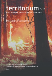 |
Items in DSpace are protected by copyright, with all rights reserved, unless otherwise indicated.